Cheriyam is the northernmost island, with a population of 10. The island has a water tank, a pond, a small 2.8-kilometre (1.7-mile) road from the village to a lighthouse at the north point. It has an area of 0.537 square kilometres. It is the largest of Kalpeni’s Satellite islands. The land in Cheriyam belongs to 49 families living in Kalpeni.
Lakshadweep Island consists of 32 coral islands, located in the Arabian Sea. Atoll, lagoon and reefs are the three main geographical features. This northern most island is the largest of the Kalpeni.The major soil types in Lakshadweep are coral sand derived from coral limestone. The islands of Lakshadweep have a soil layer overlying coral limestone. The island soil includes coral sands and lagoonal sands. These soils are highly permeable and allow rainfall to readily infiltrate, with the result that surface run-off does not occur except in local areas of compacted soils.
Cheriyam Island located near the southeast of Agatti Island in Lakshadweep, Arabian Sea The climate of Agatti is categorised as ‘Aw’ i.e., tropical savannah according to the Köppen-Geiger system of climate classification. The annual average temperature is 27.9°C, May being the warmest month at 29.6°C and August, the coldest at 27.2°C. The annual precipitation is 1575 mm. The highest precipitation of 394 mm seen in June.
BITARA ISLAND
The smallest inhabited island in Lakshadweep, Bitra is known for its lagoon area of 54.61 km² and a population of just 271 people.
CHETLAT ISLAND
Located 37 km northwest of Kiltan, Chetlat has a lagoon area of 3.79 km². It’s known for its coir-twisting tradition and a yearly growing sand spit on the northern point.
KILTAN ISLAND
This island has a lagoon area of 1.76 km² and is rich in flora. It’s also known for its high storm beaches on the northern and southern ends.
KADMAT ISLAND
Also known as Cardamom Island, Kadmat is a coral island with a lagoon covering an area of 25 km². It’s famous for its marine life and water sports activities
AMINI ISLAND
Known for its oval shape and a depression at the center, Amini Island is relatively unexplored and boasts beautiful sandy beaches and a rich marine.
ANDROTT ISLAND
Spanning about 4.9 km in length, Andrott is culturally significant with attractions like the tomb of Saint Ubaidullah and Buddhist archaeological remains.
AGATTI ISLAND
A slender island about six kilometers long, Agatti is known for its vibrant coral reefs and diverse fishes in its lagoons.
MINICOY ISLAND
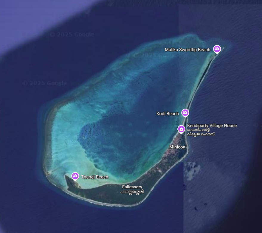
Minicoy is the second largest and the southernmost among the islands of the Lakshadweep archipelago.
KALPENI ISLAND
The Island is located at a distance of 287 km from Kochi and located south-east of Kavaratti Island and midway between Andrott and Minicoy.
BANGARAM ISLAND
This teardrop-shaped island is surrounded by a crystal-clear lagoon and coral reef, making it ideal for snorkeling and scuba diving. It measures just over 2 kilometers in length.
KAVARATTI ISLAND
The Kavaratti is the capital of the Union Territory Lakshadweep in India. The Island of Kavaratti lies 360Km of the coast of the State of Kerala at 10.57°N 72.64°E.
SUHELI PAR ISLAND
Suheli Par is a coral atoll in the Union Territory of Lakshadweep, India. It is an oval-shaped 17 km long atoll surrounded by a zone of rich marine fauna.
CHERIYUM ISLAND
Cheriyam is the northernmost island, with a population of 10. The island has a water tank, a pond, a small 2.8-kilometre (1.7-mile) road from the village to a lighthouse at the north point.
PARLI I&II ISLAND
Parali Island is an uninhabited island located east of Thinnakara Island and covered with dense coconut vegetation. The major soil types in Lakshadweep are coral sand derived from coral limestone.
PERUMAL PAR ISLAND
Perumal Par is an uninhabited coral atoll belonging to the Amindivi Subgroup of islands of the Union Territory of Lakshadweep, India. It has a distance of 2,001 km south of the city of Delhi
PITTI ISLAND
Pitti, also known as Pakshipitti (pakshi meaning “bird” in Malayalam, Telugu and Tamil), is an uninhabited coral islet in the Union Territory of Lakshadweep.
SUHELI ISLAND
Suheli Par is located 52 km to the SW of Kavaratti, 76 km to the south of Agatti, 139 km to the west of Kalpeni and 205 km to the NNW of Minicoy, with the broad Nine Degree Channel between them.
VALIYAKKARA ISLAND
The islet located 52 km to the southwest of Kavaratti, 76 km to the south of Agatti, 139 km to the west of Kalpeni and 205 km to the of Minicoy.
THILAKKAM ISLAND
Tilakkam group are a group of islands off the west of Kalpeni. The land of these islands 0.055 square kilometres (0.021 square miles) belong to two different families of Kalpeni
KALPITTI ISLAND
Noted for its scenic beauty and underwater wonders, Kalpitti is a lesser-known island that offers a tranquil experience.
VIRINGILI ISLAND
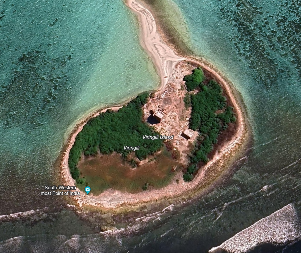
Viringili is barely 200 m in length. It is fringed with gravel and it is covered with bushes. A few stunted coconut trees grow in the center of the island. It has a distance of 0.6 km (0.37 mi) from Minicoy.
THINNAKARA ISLAND
With a total surface area of 0.42 sq. m, Thinnakkara is a coral paradise where one can find sea cucumbers, starfishes, shells, and corals on its exposed seabed.